Prof. R. A. Ramsey, one of the oldest and most successful educators of the county, is the author of the appended interesting article on Jackson Township, the dwelling place of so many of the good and substantial citizens of Huntingdon County.
HISTORICAL
This township was formed from Barree Township on January 15, 1845, and was named after Joseph Jackson, an old resident of this part of the county, who has descendants living in the township at present, viz., William Jackson, of McAlevy’s Fort, and Dr. John and Thos. Jackson, of Ennisville.
Among the early settlers of note was Gen. William McAlevy, who had emigrated from Ireland and settled in Cumberland County, Pa., but afterward (1770) concluded to push farther west and found a home on the banks of Stone Creek, in or near the village which bears his name. He acquired all the lands in and around the fort.
The fort or block house was built on the low ground near the center of the village, and was intended as a defense against the Indians, who at that time wandered over the hills and across the valleys in quest of the white man’s scalp.
The location of McAlevy’s Fort was on a line nearly directly south of Potter’s Fort, or “Old Fort,” as it is sometimes called, in Centre County. McAlevy’s Fort was built about the year 1778, at which time other forts were built lower down, one other being in the Stone Creek valley — Rickett’s Fort, located about midway between Saulsburg and Manor Hill. Of the other two, one [McCormick’s] was near Neff’s Mills, in West Township, and the other [Anderson’s] near the mouth of Shaver’s creek in Logan Township. The existence of a number of forts or block houses in this county, aside from the two principal ones, Fort Shirley and Fort Standing Stone, during the days of danger from the savages, is well established.
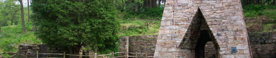
But to return to our subject. The earliest settlers in Jackson Township were engaged in agricultural pursuits, and a greater part of the present population follows the same vocation. Aside from the tilling of the soil, the next point of important industry is that of Greenwood Furnace. This furnace is one of the two charcoal furnaces in this township, was built in 1833 by Wm. Patton and Wm. Norris, was put in blast early in the year 1834, and has been in operation ever since, with the exception of about two years. In 1841 the Mitchell brothers built a small furnace on the main Stone Creek about one mile above McAlevy’s Fort. The stack proved to be badly calculated for the purpose, and the location being unfavorable, it went out of blast in 1848.
About 1829-30 a woolen mill was built on Stone Creek, two and one half miles northeast of McAlevy’s Fort. This building was destroyed by fire in 1866, and the present one erected in 1867.
In 1872 a charter was granted for the Stone Creek and McAlevy’s Fort railroad, at which time the people of Jackson Township subscribed $20,000 toward its construction, but the panic of 1873 sealed its fate for the time.
As early as the year 1820 a post route was established between Alexandria and Lewistown,, and as the route led through this township, a post office was opened at Ennisville. At present there are three post offices in the township, Ennisville, McAlevy’s Fort, and Greenwood Furnace. Previous to the year 1856 the mail was carried by a boy (usually) on horseback, and was a semi-weekly service. On the first of July, 1856, the present method of carrying the mail on this route was inaugurated. On the above date Henry Hefright, of Petersburg, put a substantial stage on the route and made three round-trips each week, the route being five miles longer then. Petersburg and Greenwood Furnace were the termini. At present there is daily mail east and west, the stage leaving the eastern end of the route, McAlevy’s Fort, at 6 a.m. and arriving at Petersburg at 11 a.m. Returning it leaves Petersburg at 1 p.m. and arrives at its destination at 6 p.m.
The township has seven churches, twelve public schools and an academy.
GEOGRAPHICAL
Jackson Township occupies the northeastern end of Huntingdon County, where Tussey’s mountain along the north line and Standing Stone mountain along the southeast line lose themselves together in the Seven mountains. Barree and Miller townships form its western boundary, and on the east are Centre and Mifflin counties. The eastern part of the township is very much broken, there being six intermediate spurs projecting westward from Centre and Mifflin counties. They are Shaver’s Creek Ridge, Greenlee mountain, Bell’s Ridge, Gettys’ Ridge, Long mountain, and Broad mountain. Bell’s and Gettys’ Ridge form what are usually called the Bear Meadow mountain.
STREAMS
Shaver’s Creek heads in the narrow red shale valley between Tussey’s mouontain and Shaver’s Creek ridge and flows west into Barree Township. Muddy Run and Laurel Run head in a deep cove between Shaver’s Creek ridge and the Bear Meadow mountain and flow south into Stone Creek below McAlevy’s Fort. Little Laurel Run cuts across the ends of two spurs of the Bear Meadow mountains and flows into Stone Creek above the Fort.
Stone Creek heads on the line between Centre and Mifflin counties and flows southwest down the red shale valley between Bear Meadow mountain and Broad mountain, and enters Miller Township one mile below Ennisville.
East Branch of Stone Creek heads in Mifflin County and flows southwest along the fossil ore outcrops between Broad mountain and Stone mountain, receiving nothing but spring brooks (except Furnace Run, which heads in the fault in Stone mountain) until it enters Miller Township.
Barr’s Saw Mill Run heads a short distance north of the furnace and flows northwest into the main Stone Creek one and a half miles above the Fort.
Herod’s Run heads south of the bed of Shaver’s Creek and continues nearly parallel with the western limits of the township, flowing into Stone Creek above Cumminsville.
GEOLOGICAL
All the mountainous half of the township has a sandstone surface covered with loose rocks and woods. The other part consists of gray and red shales and soft sandstones with lime shales.
Two loops of limestone and two high hill spurs of sandstone project from Warrior Ridge into Miller Township.
The fossil ore crop which runs in front of Stone mountain to Greenwood Furnace, there doubles back and runs westward along Brush ridge. It then bends north around the base of Broad mountain and runs northeast to the county line. Returning thence in a series of close zigzags, it follows the south base of Gettys ridge to Little Laurel Run, a mile northwest of McAlevy’s Fort. The outcrop of the Clinton fossil ore beds forms a serpentine line about sixty miles in length, extending across the head of Stone valley, between the ends of the Seven mountains and Warrior Ridge. All the fossil ore beds which have been worked in Stone Valley occur below the ore sandstone.
It might be said that the southern and southwestern parts of the township are underlaid with iron ore incalculable in quantity and rich in quality.
In less than two years we will have our long-talked of railroad, and with it will come industries that, at present, are undreamed of.
In closing, it is proper to say that the writer kindly acknowledges the aid given by Miss Sara M. Mitchell in the preparation of the historical part of this sketch. He also admits information gathered from the report of Mr. Billin, assistant State geologist.
CONCLUSION
In this sketch, as well as in those that have preceded it, there has been an effort made to adhere to facts as far as they could be obtained. Traditional matter has been treated as such. The writer will always feel under obligations to the many from whom interesting facts were obtained for the preparation of these sketches.
R.A. Ramsey, Petersburg, March 28, 1903